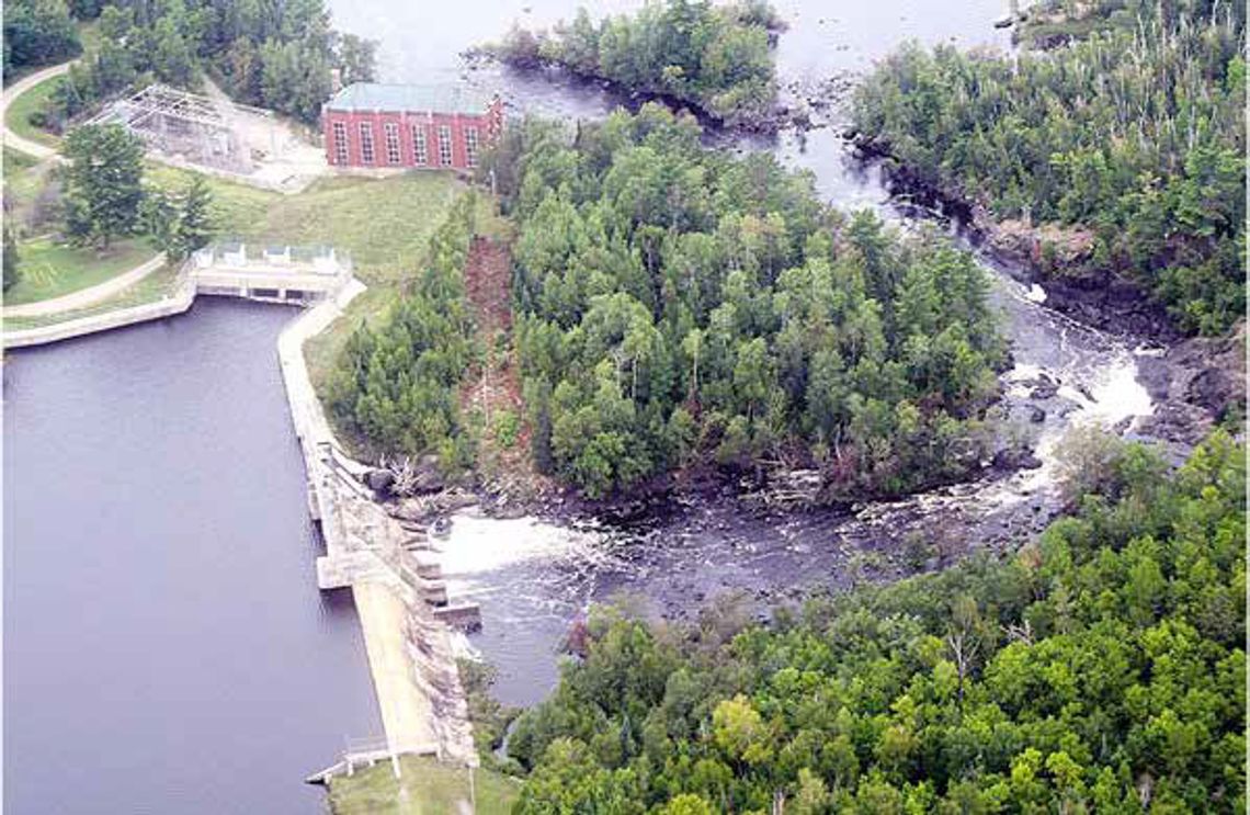
The interesting history of the Winton Power Dam (100 years old this year!) has had an outsized impact on our region.
It was almost never meant to be because industrial development plans at the turn of the last century would have put an end to the lower half of the Kawishiwi River as we know it today.
In fact, an odd quirk of legal fate in 1906 saved the White Iron Chain of Lakes from becoming something more akin to the “White Iron Chain of Ponds.” That year the Minnesota Supreme Court ruled against a plan (on appeal) to reroute the Kawishiwi River from our Rainy River Watershed south into the St. Louis River watershed and Lake Superior.
Turn-of-the-century industrialists were keen to maximize the power potential of the proposed Thomson Dam near the mouth of the St. Louis River at Duluth.
At the time, Duluth was burgeoning with logging, shipped and mining activity at the cusp of its gilded age. Hydro power was in big demand and the reroute had been readily approved by lower courts -- and it was entirely feasible.
The two watersheds are separated by the Laurentian Divide the 150-mile “Giants Ridge” geological
uplift that runs northeast from Grand Rapids to just beyond Babbitt. But in Babbitt, the two watersheds are separated only by 1.7 miles of relatively flat land.
Although no maps exist of the proposed canal routing, building a canal to connect the southwest corner of Birch in Finn Bay with the headwaters of the Embarrass River, Hay Lake near downtown Babbit, would have been a relatively simple engineering feat.
If built, the quiet meandering Embarrass River would have become a roaring torrent on its 50-mile journey to Eveleth. There it merges with the St. Louis River, whose volume would have nearly doubled.
The Thomson Hydro plant below the Fond Du Lac dam near Carlton could have produced over 100 megawatts and been among the largest hydro plants in the Midwest at the time. It is currently a 72 MW plant, the largest of Minnesota Power’s 11 dams on five river systems in northern Minnesota.
The Winton Power Dam ranks among Minnesota Power’s smallest, producing 4 MW. But it was apparently well planned because that just happens to be the city of Ely’s annual power draw (1 MW produces enough power for about 200-300 homes).
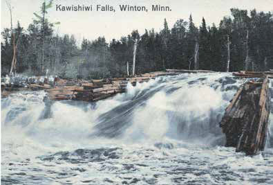
It wouldn’t produce that much if it wasn’t for the reservoir potential of sprawling Birch Lake, since it requires about 1,000 cubic feet per second of water to reach full production. That was recognized early on and in the late 1800s a log dam and sluiceway at the Highway 1 crossing allowed the massive pines being harvested throughout the region to be metered down the rapids between Birch and White Iron and on to the sawmills on Garden and Fall lakes.
Photos at the time show White Iron covered entirely in logs. That meant dangerous work for lumberjacks who delicately balanced on floating timbers while prodding and prying them through Silver Rapids. It was then a full-bore rapids, complete with a canoe portage around it (and a wooden trestle bridge built by White Iron timber tycoon Cyrus Fortier in 1903).
Many lumberjacks’ lives were lost until they began metering the flow with a huge shipping chain stretched across the White Iron narrows, which is well-named for the iron anchor rings at Ring Rock points that were in use until 1923.
Logging records suggest the amount of timber harvested from this region (including the biggest pinery of all --Basswood Lake) could have covered the entire state of Minnesota in a white pine plank one foot thick. Improbable? Maybe. But canoe-country pine is credited with building much of Chicago and the track ties for the Empire Builder Rail Line that connects the Midwest with the Pacific Northwest.
The Birch Lake spillway no longer sluices logs but it does impound Birch Lake (a 5,600acre reservoir) to ensure adequate water volume for winter operation of the Winton Power Dam. Since the spillway was first built over a century ago, Birch Lake has been about six feet higher than its natural level.
Fortunately, that higher level didn’t prevent archeologists in 1983 from discovering a shoreline Paleolithic village site where River Point Resort is now located. Hundreds of artifacts --pottery shards, stone knives, copper spear points --confirmed that people of the Laurel Culture lived there seasonally over 2,000 years ago.
If the canal to the St. Louis River had been approved, Birch Lake’s level would be higher yet since the plan called for a higher impoundment dam. It also called for both the north and south forks of the Kawishiwi to be rerouted. Hence, White Iron, Farm & Garden would have all been left with a trickle of flowage and significantly less surface area something bigger than ‘ponds’ but significantly smaller than today.
Fall Lake would have been diminished as well and there would be little left of beautiful Pipestone Falls, near where the Kawishiwi merges with Basswood border river to commence its 1,200-mile northbound journey across Canada to reach the Arctic Ocean at Hudson Bay.
In fact, it was this Canadian connection that saved the White Iron chain. The 1906 Minnesota Supreme Court decision sided with an International Border Treaty which held that cross-border water volumes could not be changed by either country.
The canal plan was scrapped, and the Winton Power Dam began operation in 1924. At the time, much of the power was routed to the newly electrified Soudan iron mine via a new 44,000-volt transmission line.
Other infrastructure improvements during that heyday of Ely’s mining and logging economy include upgrades to Highway 1 and its bridges to accommodate trucks hauling rock from granite quarries east of town to Ely’s rail depot.
But the Winton Power Dam was considered such a strategic asset, especially during World War II when local iron ore was the nation’s backbone in producing military equipment, security guards were posted there (the white sentry shacks still exist) and the windows painted black to prevent spies from peeking in.
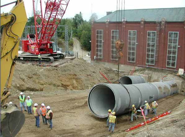
In 2005, the hydro plant with its two giant turbine generators was rebuilt. The timber penstocks that direct water from the dam to turbines were replaced with concrete pipes. Engineers noted with interest that the white pine pipes had worn only one inch after 80 years of handling 1,000 cubic feet of surging water per second.
The same year, Minnesota Power benefited the community with the creation of the Kawishiwi Falls Scenic Trail. The half-mile trek to the 70-foot falls has become a very popular recreation option for Ely residents and visitors alike.
Hikers who continue from the scenic falls overlook west down the trail toward Fall Lake will be gifted with a view of the 1924 powerhouse with its stylish “art deco-era” flourishes and now green-stained copper roof -- a reflection of the ‘boom’ times.
Those who head east up the trail can view the dam’s concrete containment wall, 725 feet long and 45 feet high-- and its adjoining earthen impoundment. This shoreline trail serves as the canoe portage between Garden and Falls Lakes.
In 2013-14, Minnesota Power replaced the Birch Lake spillway. Massive timber cribbing, built in the 1960s, were replaced with concrete piers in a $2.5-million upgrade.
The Winton Power Dam is now set to continue generating renewable energy for our region and beyond for decades to come. In fact, over 50% of Minnesota Power production is from renewable sources.
In addition to its 11 power dams, it draws from three wind turbine farms in Minnesota and North Dakota with power reserves provided by Manitoba Hydro when needed. Minnesota Power’s “Energy Forward” program relies on hydropower, together with investments in wind, biomass and solar energy, to build a more sustainable energy future The next time you pass the Kawishiwi River, give it a thankful nod. It’s a hard-working river -- just ask the ‘eager beavers’ behind its Ojibwe name which means “place of many beaver lodges.”
From its source at beautiful Kawishiwi Lake, it serves as a very popular canoe route for 35 miles through the Boundary Waters. Then when it enters the White Iron chain, it helps power Ely’s recreation economy for another 35 miles since many of the area’s lodges, outfitters, guide services and camps lie along the chain.
Along its 70 miles, it feeds 18 lakes (all great fisheries!) and then ends at Fall Lake where the biggest drop in its 300-foot total descent is harnessed to power Ely.
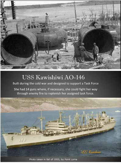
Fun fact: it’s also the namesake of a 700-foot U.S. Navy refueling ship that served in the Pacific Ocean from 1955 to 1992: the USS Kawishiwi. The ship was commissioned by then-Senator Hubert Humphrey in Philadelphia in 1955 where --for the assembled Navy brass-- he extolled the beauty of the “wilderness area” where the Kawishiwi flows.
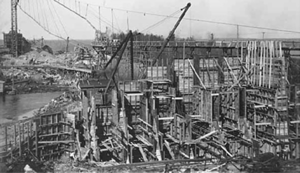
Winton Power Dam penstocks being constructed in this undated photo.

