Part 4 – St. Ignace to Duluth
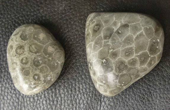
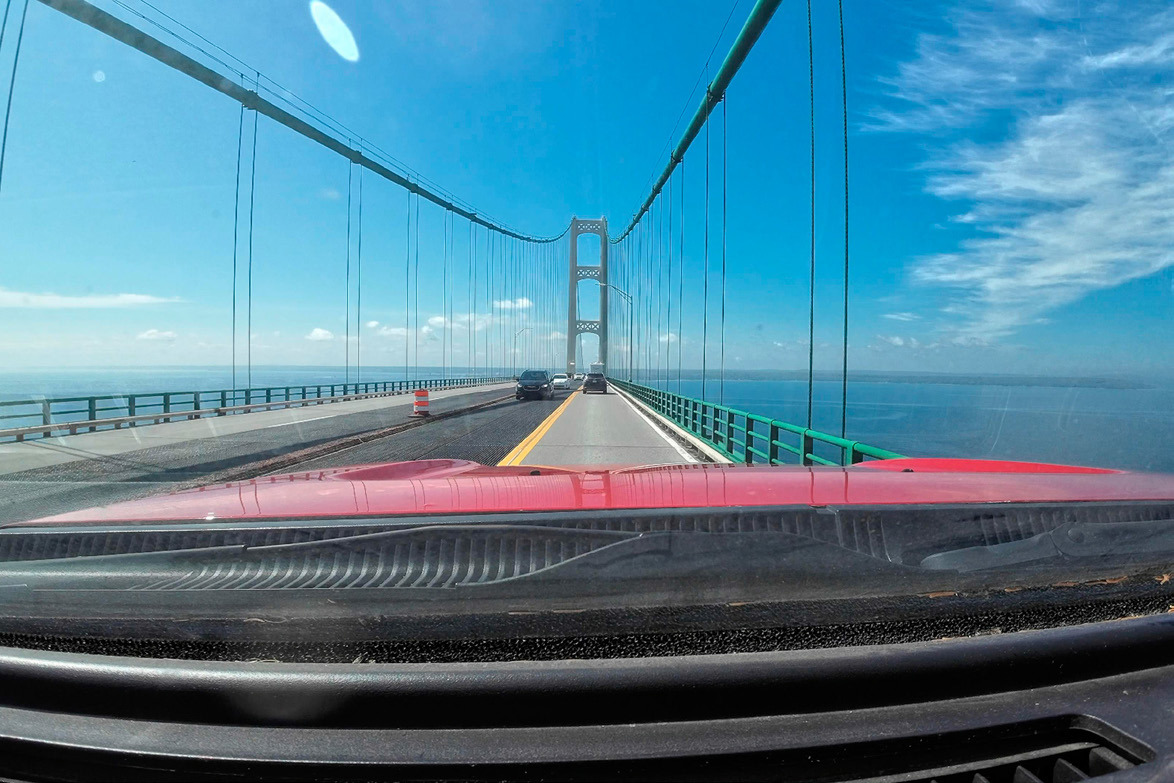
We spent two nights at Straits State Park in St. Ignace. We got in late on the 16th, just in time to set up camp and settle down for the night. We spent the 17th crossing the Mackinac Bridge and moseying down to Petoskey State Park on Lake Michigan for Beth to beach hunt for some Petoskey stones. These unique rocks are fossils composed of petrified coral from about 350 million years ago. It takes a keen eye to pick one from the beach because they look very much like any piece of limestone you may come across. When polished, they have an intriguing pattern and shine to them. They have been adopted as Michigan’s State Stone. You can pick 25 pounds of these per year, and Beth came close to that limit! We took our time driving back to the campground, stopping at several antique shops along the way. It seems that the U.P. of Michigan is an antique hunter’s paradise with shops dotting the route all along the way!
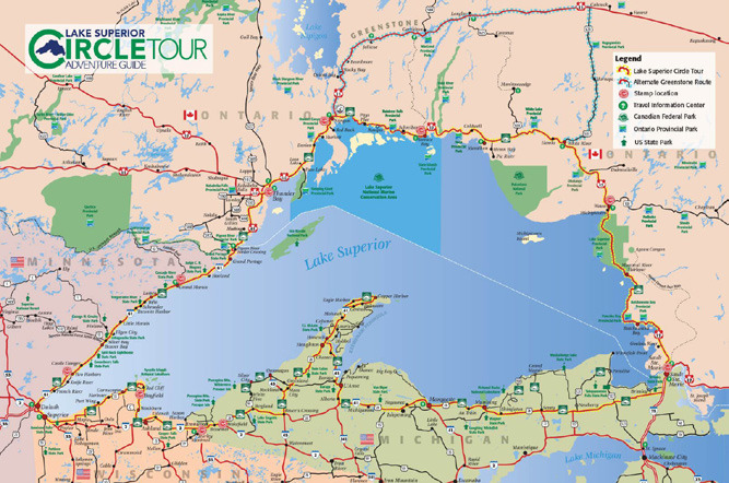
We took off early on the 18th to head back up to the designated roadways of the Circle Route. We took a direct route to Munising, and in doing so missed a small portion around Whitefish Point.
We will have to make a destination of that in the future. Besides the Great Lakes Shipwreck Museum and the Whitefish Lighthouse, the area is also known for its great birding opportunities and rock picking. Most would recognize that the Edmund Fitzgerald sank only seventeen miles from the lighthouse.
On the way to Whitefish Point is also Tahquamenon State Park.
I’m told that its natural features, including waterfalls, are spectacular. We spend enough time in the U.P. to be assured of hitting these destinations on a future trip.
We hit Lake Superior again at Munising. The main focus here is Pictured Rocks National Lakeshore, however there is much more to do here. A historic downtown area has museums and many eating establishments, gift shops, fish markets and antique stores.
There is a large camping park just to the west of the city limits, and many smaller campgrounds and cabins dot the shoreline for parking or rent.
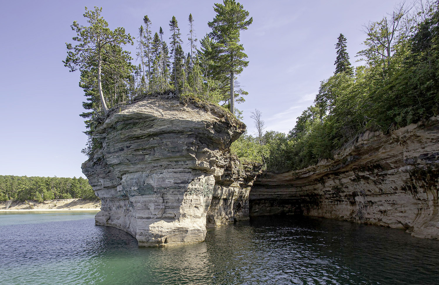
Pictured Rocks National Lakeshore is a fabulous destination spot, with easily five or six days that could be spent here. Besides many hiking trails (short, medium and long), there are museums, historic and cultural buildings, kayaking rentals and ferries out to Grand Island, which can be a multi–day adventure. The Pictured Rocks Cruise is a must!
The route west follows Lake Superior closely with many rest areas/picnic spots, small communities
and campgrounds as the Tour winds its way to Marquette.
Marquette is a large community of about 21,000. Northern Michigan University is housed here and increases the population during several months of the year. Again, many museums, parks and other points of interest can be found here.
If you’ve ever listened to “Da Yoopers” (Second Week of Deer Camp), the next fifty miles of travel takes you through their stomping grounds. Driving through the towns of Ishpeming, Ontonagon and Negaunee almost necessitates playing their album “For Diehards Only”!
Continuing to the west, we soon come to the small towns of Wakefield and Bessemer. These are entry points to the south of Porcupine Mountains Wilderness State Park. One of my favorite destinations along the South Shore, this wonderful area of backcountry hiking, beachcombing and picturesque views allows Beth and me to pick agates and practice photography to almost no end. Lake of the Clouds is a must see and Copper Peak Ski Flying Hill is just to the west of the park. You can ride to the top of the jump and on clear days might see 40 miles in all directions. A trip in the fall is ablaze with color!
This park has two campgrounds.
The one on the east side of the park has hook-ups and can be very busy. The west campground is more primitive and much quieter. It sits next to the Presque Isle River and a series of wonderful waterfalls.
In winter the ski areas of Big Powderhorn and Jackson Creek Summit, as well as hundreds of miles of snowmobile trails make this area a favorite winter destination as well.
Ironwood comes next, right on the border between Michigan and Wisconsin. Beth’s mom was born and raised here, and we take several trips a year traveling to this community. The town itself is an old mining town, and as such has seen its better days. However, there is a renaissance happening in the downtown area including the renovation of the Ironwood Theater. Part museum and part theater, it is an active member of the arts community in this part of the state.
The Black River Harbor Campground in the Ottawa National Forest is nearby. Although we have hiked and picnicked in this area, we usually camp at Little Girl’s Point. This is a county park north of Ironwood. Right on the shore, it is quiet and peaceful.
There aren’t many spots, and it is usually full. Call ahead! There are some electrical hook-ups available, and the nightly fee is $30.
No stop in Ironwood would be complete without getting some pasties at Joe’s Pasty Shop.
Little pasty shops are all along the route, but Joe’s has been our favorite. Hours are limited but they do have a website to check for open days.
I also like to stop at “Little Finland” just out of town. A small park with some historic buildings that can be toured and a gift shop sits on the property. If I’m lucky, there will be some of the Finnish ladies tending the shop who will offer coffee and ‘pulla’ and good conversation while you are there.
The Finnish “brogue” brings me back to my childhood days!
Entering Wisconsin, we move away from the lake for a while.
Rolling countryside with family farms usher us along the way.
We again meet Lake Superior at Ashland. A larger town of about 8000, its mascot name the “Oredockers”, tells much about the history of this community. There is a “new” part of town, as well as a more historical “old” part of town. A nice park and beach can be found on its western edge.
Just outside of town Northern Great Lakes Visitor Center with exhibits, picnic grounds and a bit of a hike.
Also, just to the west of Ashland is the cutoff to Bayfield.
Bayfield is small but reminds me of what an eastern seaside town would look like. Quaint with small shops and a New England flavor, its downtown area is bordered by a large marina and park.
Sailing, kayaking and exploring ice caves in the winter are all popular activities here. It is also known as the “Gateway to the Apostle Islands” and runs a ferry to Madeline Island several times daily.
Bayfield is also known for its cultural amenities and performing arts. The “Big Top Chautaqua” hosts live music every summer.
The town also has its “Apple Festival” in October. I dare you to find a parking spot for that!
I once stayed in a small hotel in downtown Bayfield while taking a sailing class. It was an old but well-kept building, and with its decor I could easily imagine myself having stayed there in the early 1900’s!
As we go west from here several small towns offer different feels to the journey. Iron River is small but has just about anything you might want. Brule, which lies alongside the Brule River – world famous for its trout fishing and having hosted five U.S. presidents. I’ve personally fished for brown trout, brookies, rainbows and steelhead in this river. Fantastic!
Poplar is a small whistlestop that is the birthplace of Richard Bong, WW2 fighter plane ace.
A museum dedicated to him is just down the road in Superior, Wisconsin.
By my count, there are at least a dozen campgrounds between Ashland and the city of Superior.
Going inland a few miles, there are many more. Some are in state forests, and some are private.
Some of the state forest campgrounds are free but come on a first come, first serve, basis.
We are now almost back to our starting point of Duluth. On our trip we logged 1580 miles (about 2542.76 km for our Canadian friends). To put that in perspective, that is about half the width of the United States! We averaged about 11 miles per gallon for around 144 gallons (about 545.1 L) of gasoline. The average cost of gas was about $4.12 for a total of $593. We stayed for seven nights in campgrounds, all with at least electrical hook-ups. Average cost per night (the one KOA bumped this up a bit) was around $55 for $385. We ate one meal in a restaurant, one fast food (Tim Hortons) and the rest was prepared by us at the campgrounds.
Meals, food and munchies came out to approximately $250.
Entrance fees to museums and tours (would have been more if more had been open) - $65. Three buckets of rocks at the amethyst mine was $90. A few odds and ends - another $75. Our total trip cost about $1458. That doesn’t include a major purchase that will be discussed in part 5.
Next week, we explore one of my new favorite places – the Keweenaw Peninsula!
.jpg)
