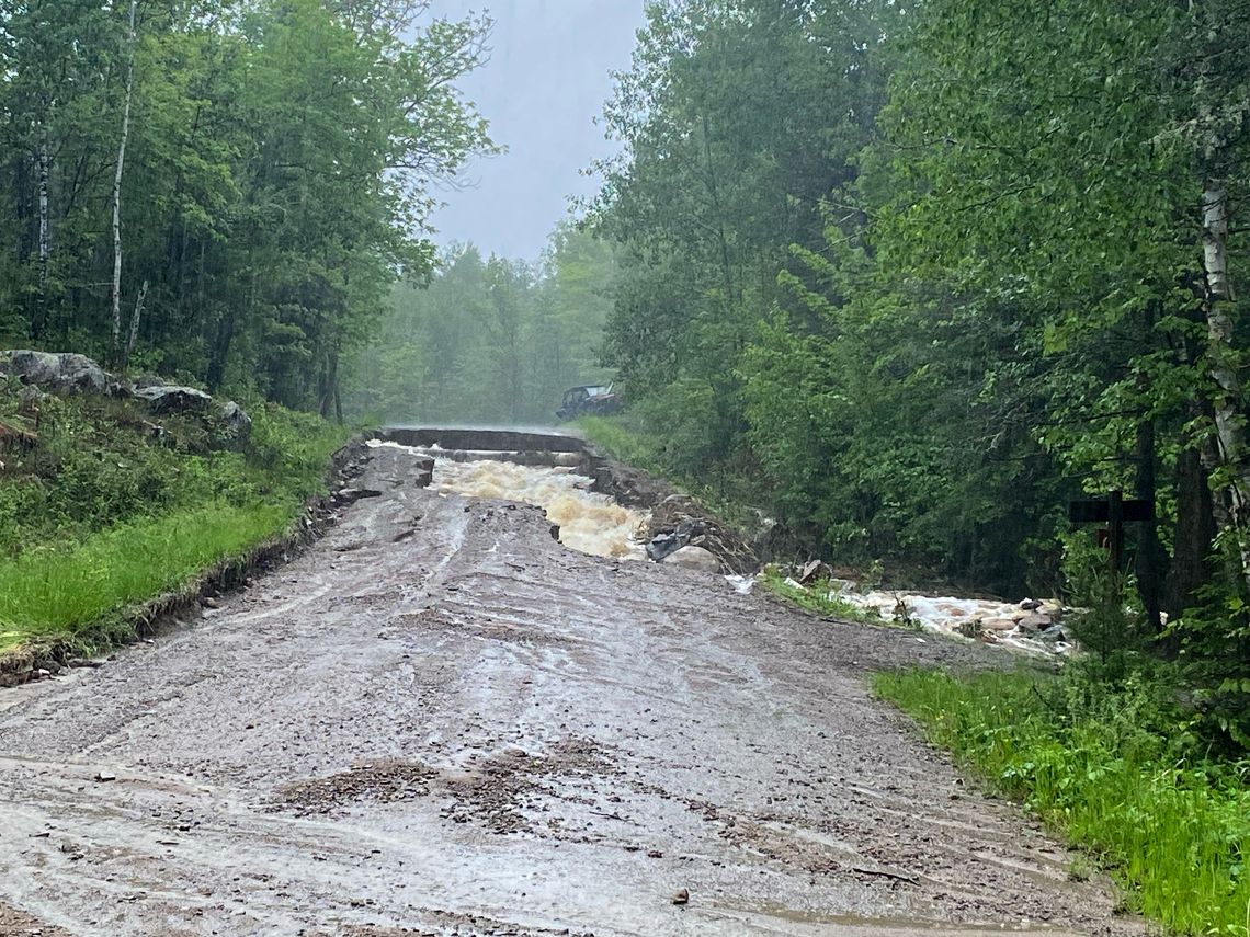
Roads in the Ely area including the North Arm Road off the Echo Trail and Mud Creek Road between Ely and Tower suffered serious damage due to a rain laden storm system that passed through on Tuesday.
There are reports of damage along the Echo Trail and the Morse-Fall Lake fire department posted the following: "Today's rain has caused a lot of damage through out the area. Please be safe and travel only if you need to. If a roadway is covered with water, it may be washed out. Please report any hazards you encounter by calling 911. Crews are out dealing with issues now and will be working through the night and into tomorrow."
The Minnesota Department of Transportation is closely monitoring road conditions after heavy rainstorms passed through northeastern Minnesota yesterday and last night.
As of 9 a.m. Wednesday, June 19, the following highways are closed:
- Highway 1 between Sassas Road and Brown Road (15 miles west of Tower). The road has washed out and a detour is in operation.
- Highway 1 east of Ely (MP 293.7). The road has washed out and a detour is being installed.
- Highway 53 just south of Independence. One southbound lane is closed.
- Highway 61 at Taconite Harbor. One lane is closed and a signal-controlled bypass is in operation.
- Highway 169 between Karjala Road and Koski Road south of Tower. The road is closed.
MnDOT staff are doing damage inspections to determine if roads are weakened, and motorists should use caution where shoulders may be washed out. Do not drive over water or around barriers closing off flooded roads as roads may have collapsed underneath the water. 511mn.org will be updated throughout the day with the latest conditions.
Flash flooding and severe thunderstorms have caused damage across the Superior National Forest (SNF) during the June 18, 2024 storm. Forest Service staff in all five District Ranger stations are currently assessing the extent of the damage across the 3 million acre forest, specifically at BWCAW entry points, campgrounds, roads, and trailheads - updates will be provided as we verify and make assessments of the damage.
All visitors with reservations over the next few days for BWCAW Point of Entry or campgrounds that are severely affected by storm damage will be contacted directly.
If a visitor has reservation questions, please call the local District Ranger office. Forest Service staff reminds all visitors to adhere to local weather warnings and please travel safely.
The damage along North Arm was captured in this video:
.jpg)


