.jpg)

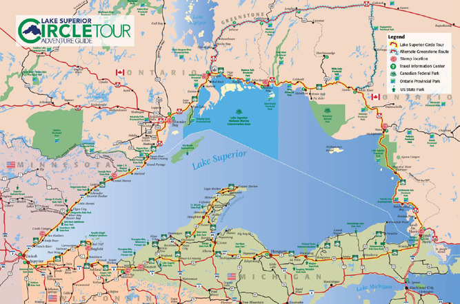
Part 3 – Thunder Bay to Sault St. Marie
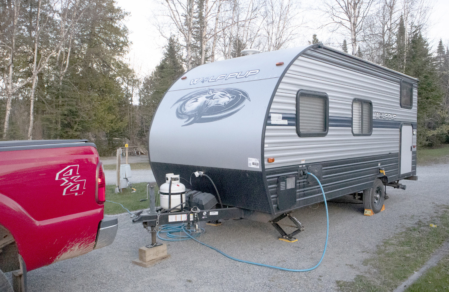
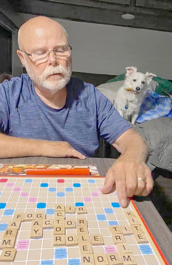
Our first night’s stay just outside of Thunder Bay was a pleasant one. It felt good to spend a night in the camper and shake the cobwebs out of being on the road again. It was cool and the furnace felt good. The pups were tucked in, and Beth and I played a game of Scrabble before turning in.
We had some general ideas of what we planned to do, but allowed for serendipity to determine where this day would end up. Exploring always leads you to unintended paths and discoveries – and that’s a part of traveling I enjoy. This KOA is next to Sleeping Giant Provincial Park.
Hiking, kayaking and camping in the park are all activities that you can enjoy here. Today, our schedule would take us elsewhere.
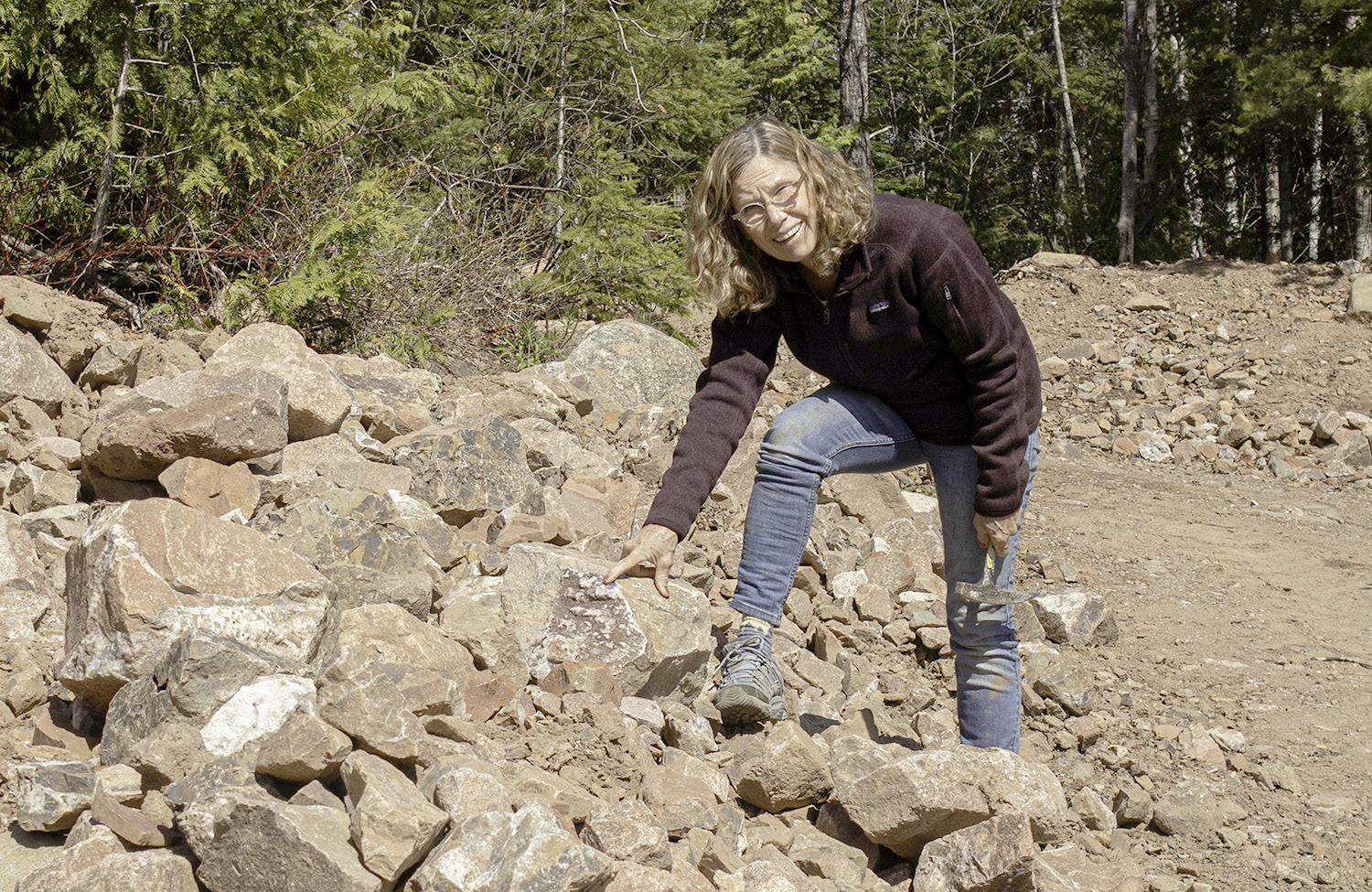
Beth is a class one rockhound.
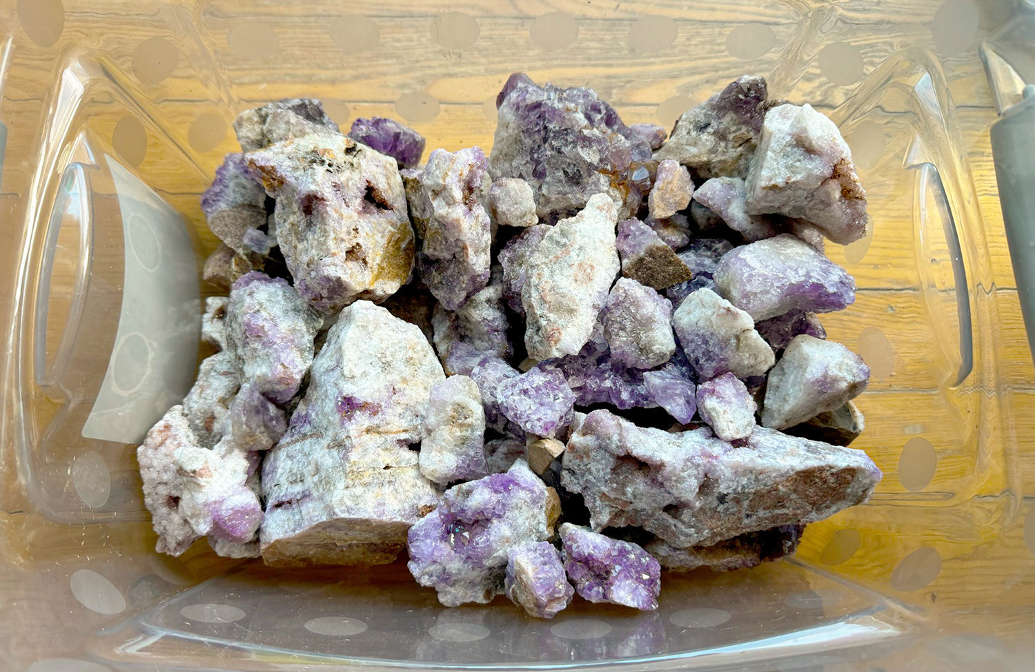
We spend some hours out combing beaches, exposed riverbeds and rock shops every time we head east of where we live. This first morning would be no exception. Just 30 kilometers down Highway 17 to the east is the town of Pearl. Moving inland a short distance are three amethyst mines. Formations of the purple rock break the surface in several places in this hills. Though called “mines”, they remind me more of excavations. Some of the mines require an admission fee, some do not. Some allow for looking only and some encourage you to pick some to bring home. All have gem shops with specimens and jewelry made from this form of colored quartz. The Diamond Willow Mine opened for the season the morning we got there.
The other two were closed. Lucky for us (Beth!), this mine had no admission fee and you could pick to your heart’s content! Thirty dollars for a two-gallon bucket.
We left with three! Beth’s rock tumblers will be busy all summer! It opened at 10:00 and by noon we knew we had to be checked out of the campsite and on down the road. We packed up the camper and headed east.
Traveling in Canada is easy for Americans. Canada has two official languages – English and French. English is primarily used on the journey around Lake Superior and is the same except for some local colloquialisms.
Money conversion is simple, the electrical grid is the same and most travel directions are easy to follow. There is a different flavor, however. Once you cross the border into Ontario there are some changes that tell you that you are not in the U.S. anymore. I enjoy it. For most of us, it’s as close to an international experience that we’ll ever see.
One of the biggest differences is that Canada is on the metric system. That means liquid is measured in liters (sometimes spelled litres – how European!) instead of gallons and distance is measured in kilometers instead of miles. We’ve already mentioned buying gasoline and interpreting liters to gallons and Canadian dollars to American, but the next level involves wrapping your brain around how far it is to the next destination. Seeing a sign that says “Wawa - 600 km” can blow your mind! “It’s going to take me two days to get that far!”
Interpreting to miles helps to settle the heart. A kilometer is approximately six-tenths of a mile.
So, if you multiply the kilometers by .6, you’ll quickly understand how many miles you’re actually dealing with. Take 600 times .6 and you come up with 360 miles.
That’s a number that’s easier to comprehend. It doesn’t take long to get the feel for the distance conversions as you travel along.
Speed limits must also be converted. When you see a sign that says the limit is “100”, be careful!
The same six tenths conversion applies. Their speed limits mimic ours closely. A sign that says “100 km” will convert to approximately 60 mph. Other common limits are “90 km”, about 55 mph and “50 km” or about 30 mph.
Some speedometers will have the conversion marked. Digital ones will not.
Most other signage is the same as ours. Road markings in larger cities can be a bit different and may sometimes confuse. Knowing your route ahead of time helps a lot. Most other road rules are similar to ours.
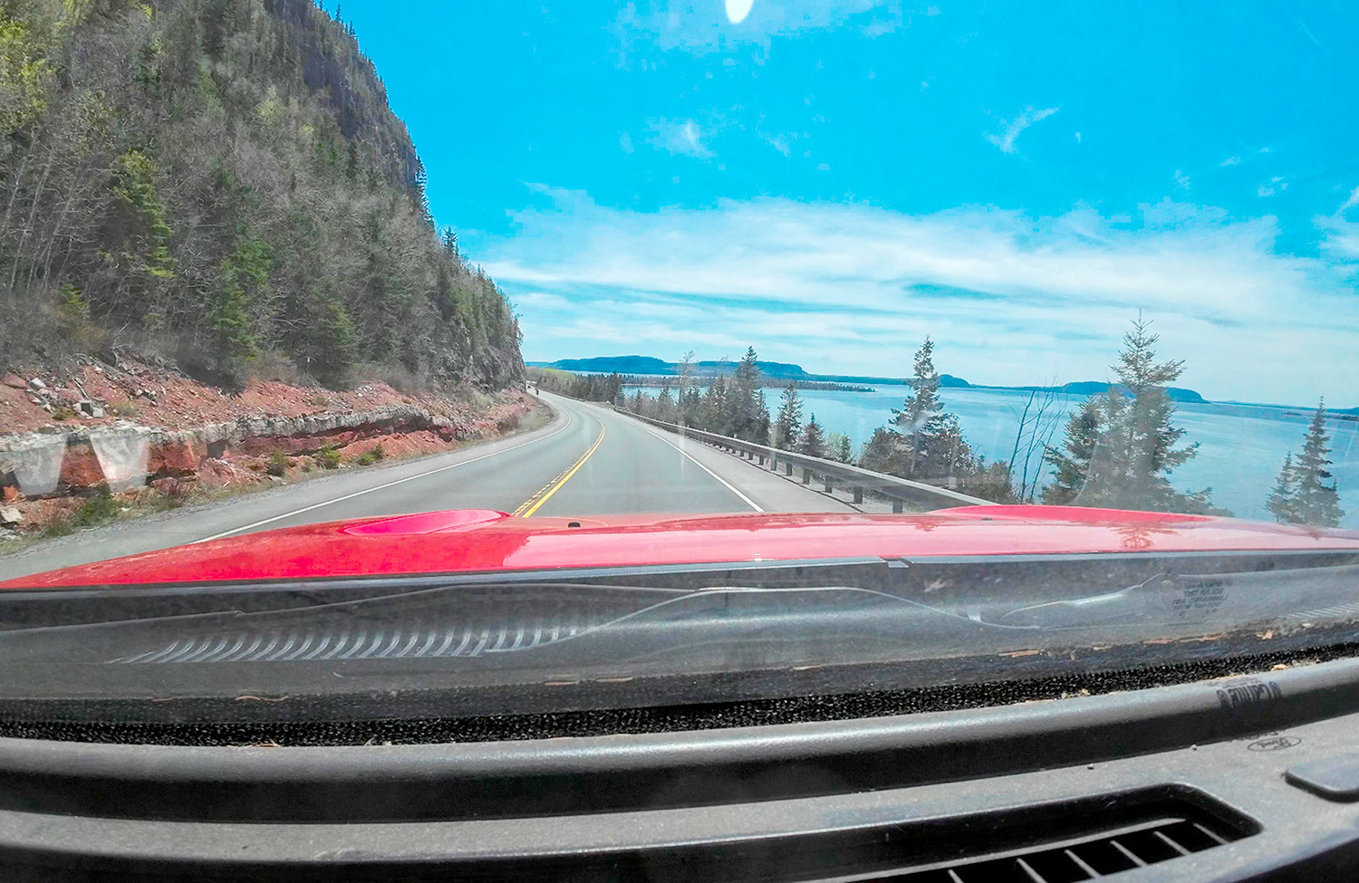
Our journey on this day took us along the shore eastward towards Sault St. Marie. We knew we weren’t going to make it that far but would let the day guide our travel. We found the most road construction on our trip starting at Pearl and continuing until Rossport. There is major reconstruction going on in this stretch, and I would suspect it will last through this summer.
Other, smaller projects dotted the Canadian side, but they were over short distances and should be done soon.
The Canadian side of the Circle Tour has much less for varied activities. The scenery is spectacular and there are many overlooks and pull outs. Much of what to do involves hiking and kayaking along the shore from communities and small local parks. Fishing is big at some destinations, especially around Nipigon. Lake Nipigon and its flowage into Lake Superior boasts the best brook trout fishing in the world. There is also a split of the route here, with HWY 17 continuing around the Lake and HWY 11 heading north towards the interior.
There are few museums and other attractions. Lakeside communities can be quaint and commercial fishing is prominent.
Some will provide small camping areas and a motel or cabins for rent. A single gas station with a convenience section might be available but don’t count on it. If you’re down to half a tank and have a chance to fill up, take it!
Some of the route moves away from the lake for miles, but the countryside is equally interesting.
We didn’t see any, but moose crossing signs were abundant.
Elevation goes up and down a lot – especially until Rossport, and pulling an RV was a bit of a challenge.
We had considered stopping at Rossport for the night, but the town was smaller than we expected. There was a nice-looking municipal campground on the outskirts, but it wasn’t open for the season yet, so we moved on.
The next larger community that we saw on the map was Marathon. It is a nice community that was built around logging and the railroad in the early 1900’s, but declined until recently when gold was discovered a few miles to its east in the 1980’s. It’s a clean and pleasant community with several businesses, a very nice park and a beach along the lake. We stayed at a municipal campground called Penn Lake Park that was very nice. Located about a mile out of town, it was quiet, clean and had a hiking trail around a small inland lake. Full hook-ups were $41/American for the night. Total miles driven this day – 178.
We got an early start the next morning and had planned to stay one more night in Canada.
Highway 17 moves well away from Lake Superior, widely skirting Pukaskwa National Park. A kayaking mecca, this park is a destination for many travelers. If


")


